Monthly Archives: July 2018

Gordon Dam

After leaving the Serpentine Dam we continued along Gordon Rover Road to the end of the road, where we came to the Gordon Dam.

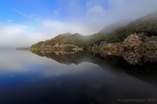
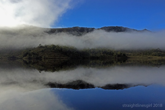
Lake Gordon, created by the dam, was still shrouded in fog so it was impossible to see how big it was, but we could see the dam wall itself, which is pretty impressive.

20180712-060 Lake Gordon

Lake Gordon

Completed in 1974, it’s 140 metres high and is the highest arch dam and the largest storage dam in Australia.

20180712-097 Looking down on the Gordon Dam wall

The view from near the top of the steps

It’s curved both horizontally and vertically, which allowed them to use less concrete in construction, reducing the overall cost. The dual arch explains why it doesn’t look straight. I thought my eyes were playing tricks on me!

20180712-100 Looking down on the Gordon Dam wall

View from the lookout. There are people walking along the wall.
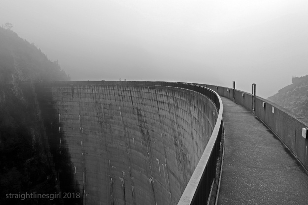
20180712-092 Looking down on the Gordon Dam wall

Top of the dam wall

20180712-089 River side of Gordon Dam wall

Gordon River side of the dam wall

20180712-081 Gordon River

Gordon River

20180712-077 Gordon Dam wall

Looking back up to the road


Serpentine Dam

The Serpentine Dam is part of Lake Pedder or, to use its technical name, the Huon Serpentine Impoundment. The dam was constructed in 1971 on the Serpentine River.

About two km west of Strathgordon, you pass the Lake Pedder lookout. This day, it was foggy and the lookout view was non-existent.

20180712-003 Silhouettes in the fog at the lookout

At Lake Pedder lookout

20180712-011 Silhouettes in the fog at the lookout

Good for silhouettes

Continuing along Gordon River Road for another seven km, you reach the turnoff to the Serpentine Dam. From there, it’s a short drive to the boat ramp.

20180712-023 Serpentine Dam the other side

The road to the dam seen from near the boat ramp

20180712-028 Serpentine Dam the other side

Lifting fog over Serpentine Dam

20180712-037 Serpentine Dam

Fog over Serpentine Dam

20180712-040 Serpentine Dam

Hillsides peeking through the fog

20180712-035 Serpentine Dam

Mist emerging from mist

And from there, it’s another short drive to the dam wall.

20180712-043 Serpentine Dam wall

Serpentine Dam

This is a concrete-faced rockfill dam, which is basically a compacted rock wall that is made waterproof by a thin layer of concrete on the upstream face (the left side in this picture). The wall is 41.5 metres high at its highest point and 134 metres long. It contains 114 000 cubic metres of rockfill.


The Sentinels

Along the Gordon River Road heading towards Lake Pedder is a spectacular range called The Sentinels. It’s a quartzite range about five km long and one km high and it would seem the most common reaction of people seeing it for the first time as they drive round the bend is, “Wow!”

That was certainly my reaction. This range took my breath away when I saw it from the road. Over the three days we were in the area we made several photo stops here, and here’s what we saw.

Day one—sunny, beautiful sky

Photos from the road to Strathgordon.

20180711-057 The Sentinals edit copy

Day 1: From the road

20180711-061 The Sentinals edit copy

Day 1: From the road

20180711-062 The Sentinals edit copy

Day 1: From the road

Day two—started out foggy, mostly cleared up in the afternoon

Photos from a couple of roadside stops in the afternoon sun.

20180712-178 The Sentinels copy

Day 2: From a convenient cutaway

20180712-183 The Sentinels copy

Day 2: Zooming in

20180712-185 The Sentinels

Day 2

20180712-187 The Sentinels copy

Day 2: Looking up

20180712-194 The Sentinels

Day 2: Zooming in

20180712-195 The Sentinels edit copy

Day 2: In a different light

Day three—nothing to see here

Photos from a roadside stop on the way home in the fog.

20180713-021 Near the Sentinels copy

Day 3: Over the road

20180713-022 Sentinels copy

Day 3: Misty

20180713-030 Sentinels

Day 3: Still misty