Open House Richmond was a one-off Open House event held in February 2024 as part of the Richmond Bicentenary.
Located on the land of the Mumirimina people of the Oyster Bay Nation, Richmond hosted a number of events between December 2023 and February 2024 to commemorate the history of the town.
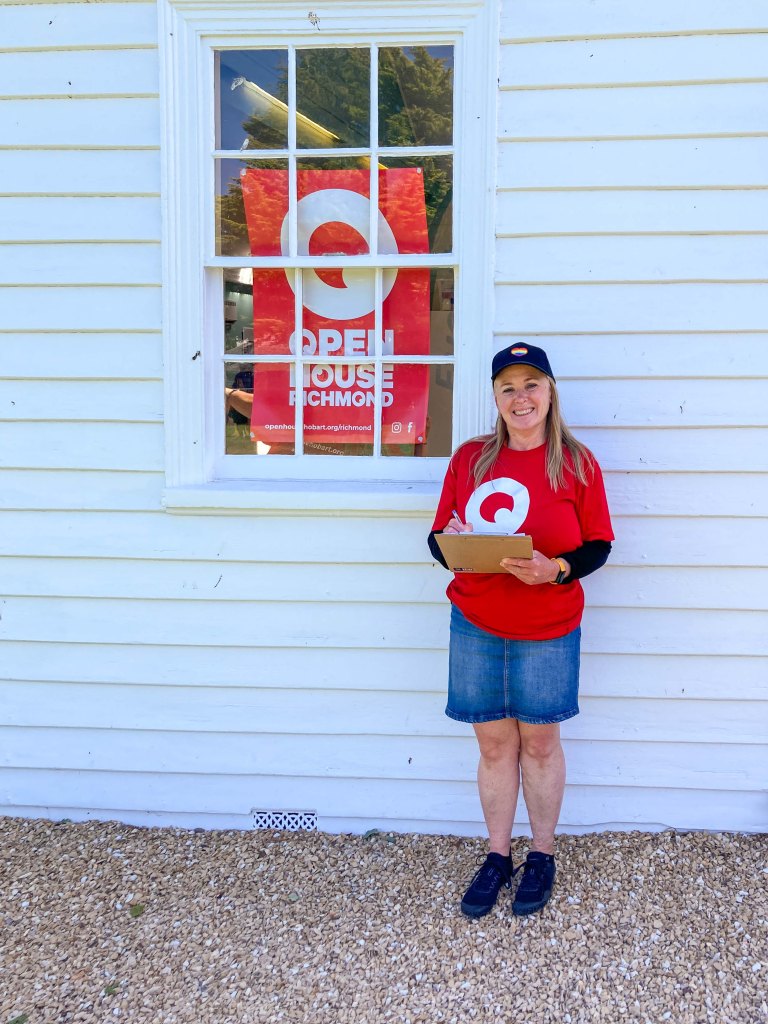
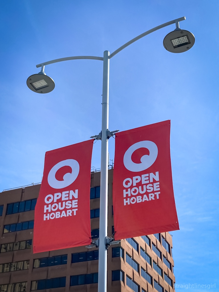
Having attended many Open House Hobart events in the past, my sister and I decided it was well past time that we volunteered at one of these weekends, so we put our hands up to help out on the Saturday morning.
I finally got to hold a clipboard! (NB not the building I was volunteering at) Photo by Carryl M.
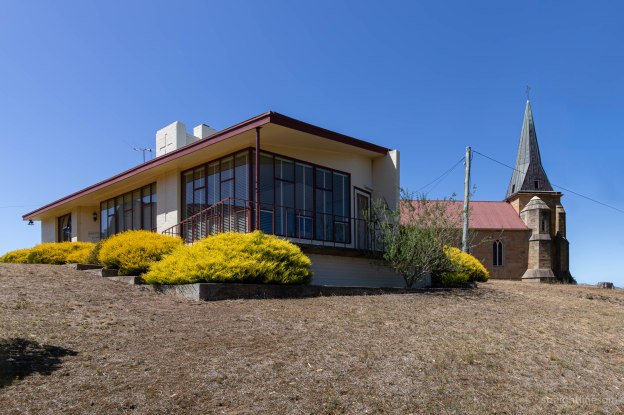
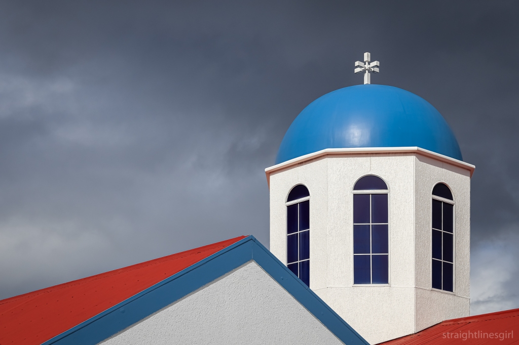
We were allocated to the St John the Evangelist Church precinct for three hours on Saturday. Our job was to tally the number of visitors and ask them for their postcodes. If you’ve been to Open House events before, you’ll know this drill.
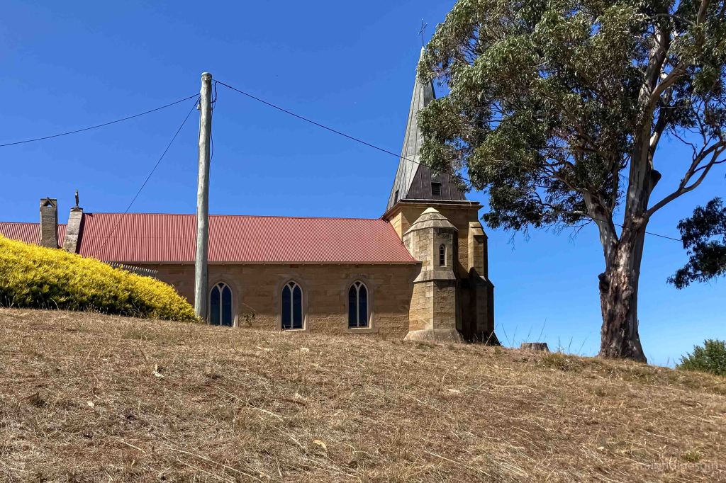
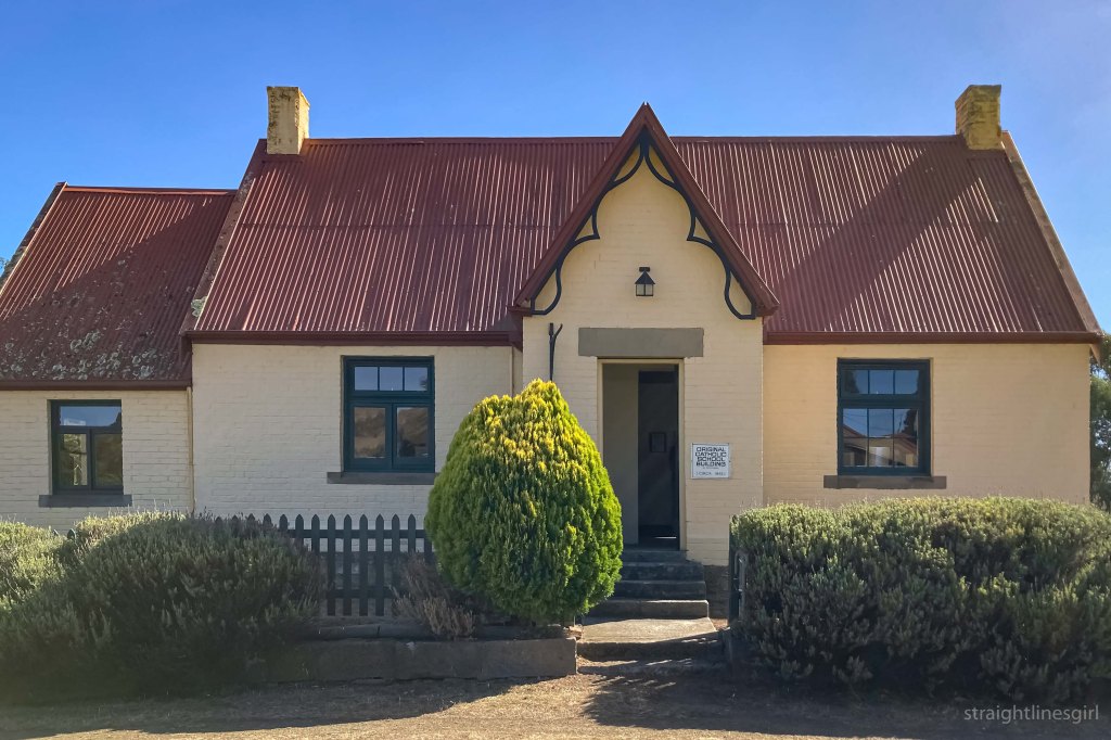
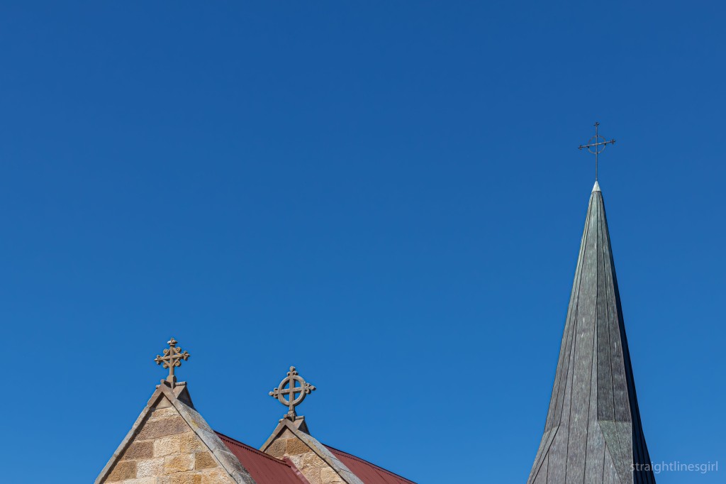
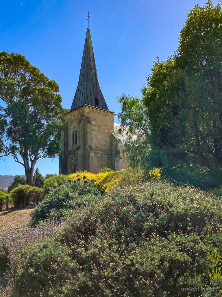
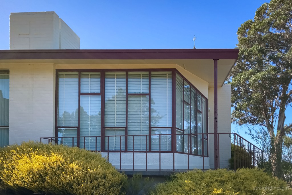
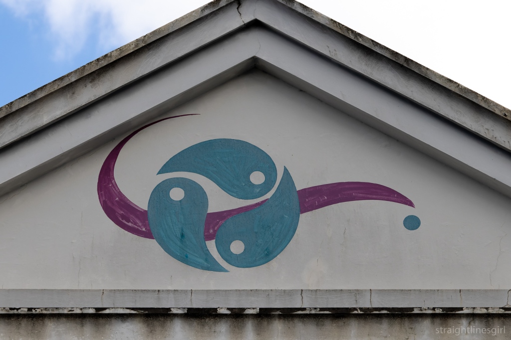
St John the Evangelist Church
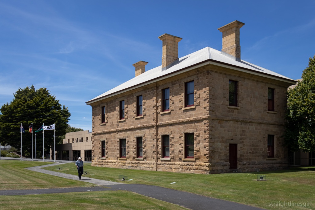
The church (dating back to 1835) and the old school house (1843) were open to the public. The 1959 presbytery wasn’t open, but visitors were invited to walk around and admire its modernist excellence.
Wesley Stacey Exhibition
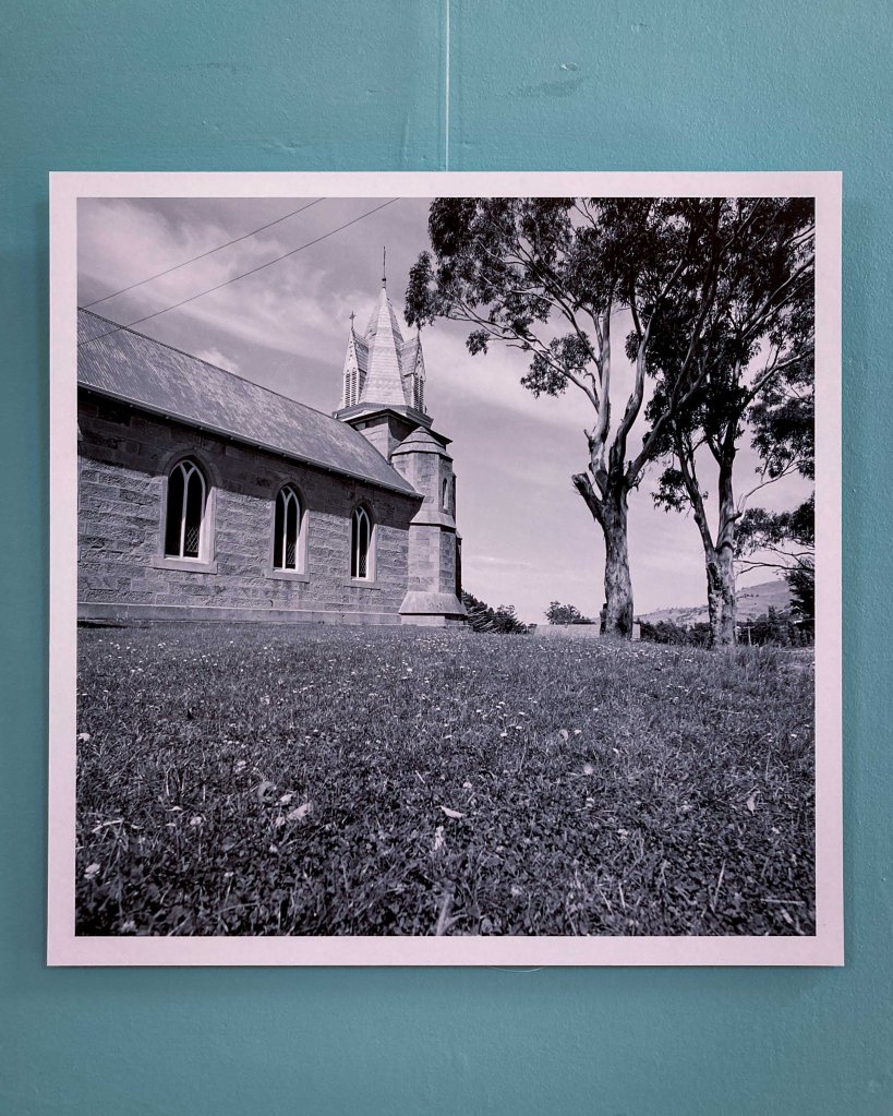
Before we headed off to the church, we took a look at the Wesley Stacey photo exhibition of Richmond in the 1960s. Wes Stacey (1941-2023) was an Australian architectural and documentary photographer who came to Richmond in 1968 to document the town.
Wesley Stacey 1968 Richmond
The exhibition notes tell us
Wes was in Richmond for a few days in 1968 during which he brought an artist’s eye to the town just prior to its emergence from a century in the doldrums. Bypassed by roads, rail and causeways, Richmond settled into a period of reduced relevance and quietude, which saved it from unsympathetic development. Wes’ photographs record a very locally-focussed Richmond and present a perspective on the village just prior to its reinvention as a heritage tourism hot spot.
It was cool to see this photo of the church we were about to visit.
Wesley Stacey’s 1968 photo of St John the Evangelist Church
The exhibition was curated by Richmond Bicentenary Creative Director, Noel Frankham. The photographs form part of the “Wes Stacey archive of architectural photographs, 1968-1972”, held by the National Library of Australia.
It’s an amazing collection of almost 3,000 photos.
St John the Evangelist Precinct
Three hours was a lot of time to explore the area in between visitors. Here’s some photos.
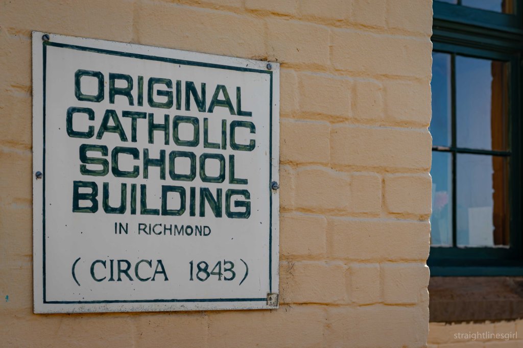
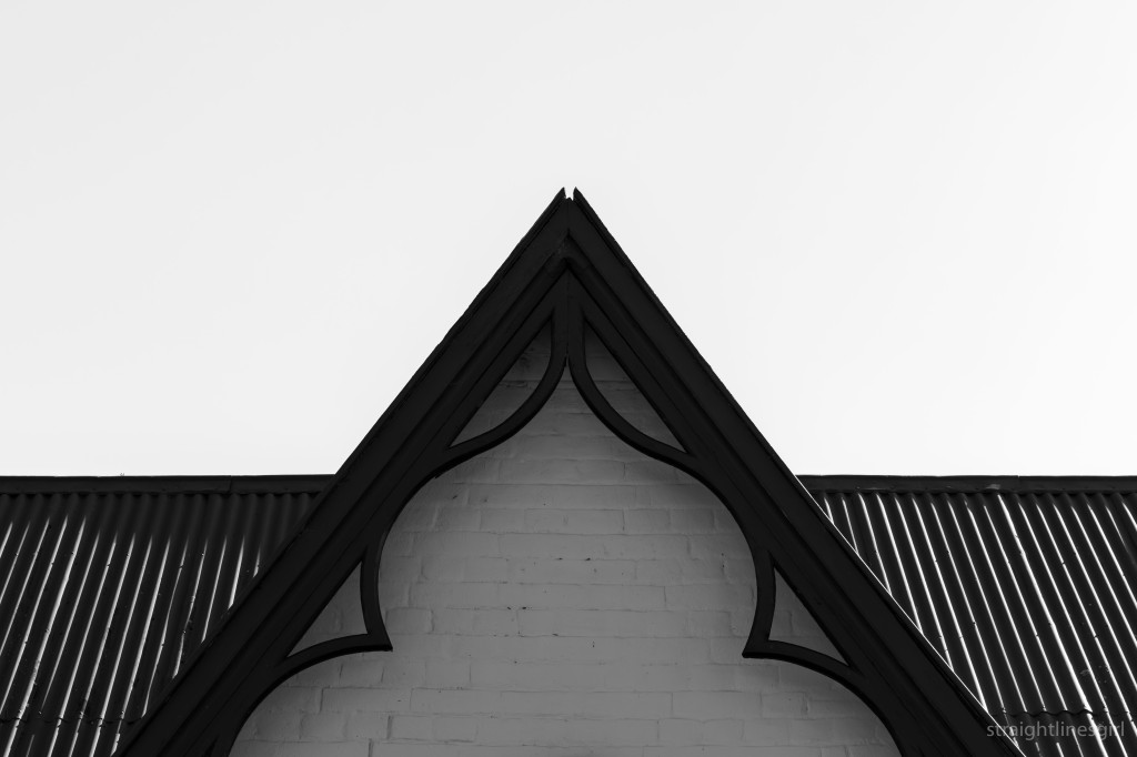
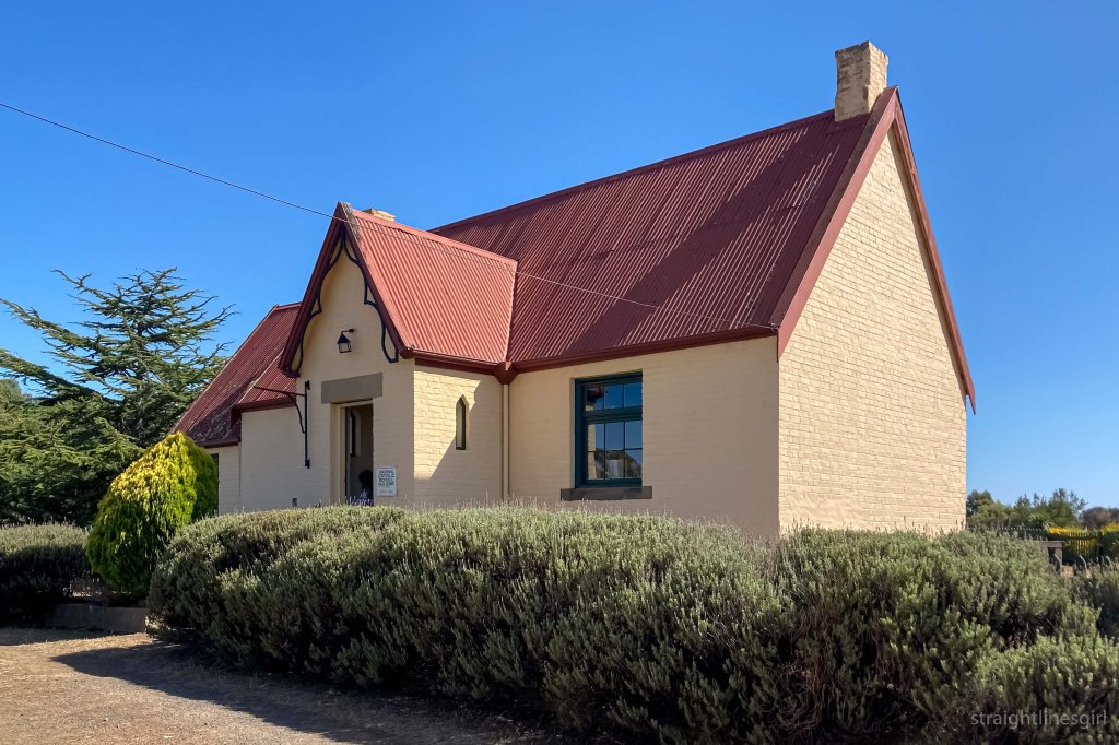
Old Catholic School House (1843)
Old School HouseOld School HouseOld School HouseOld School House
St John the Evangelist Church (1835)
Church toppersChurch seen from the roadThe church and the presbytery
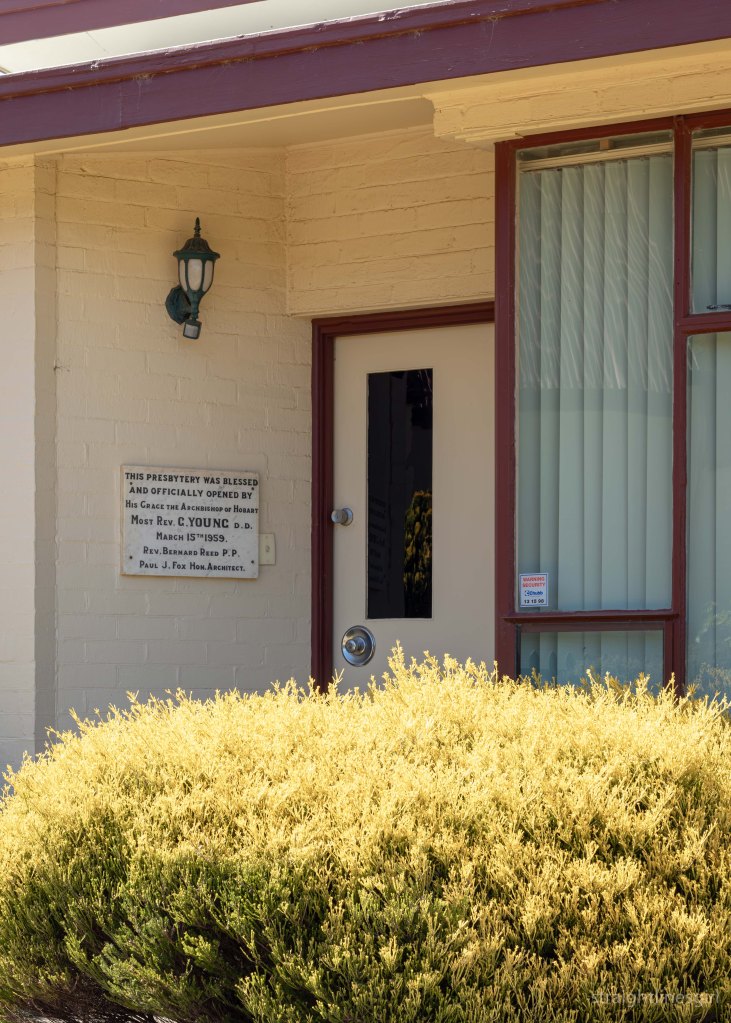
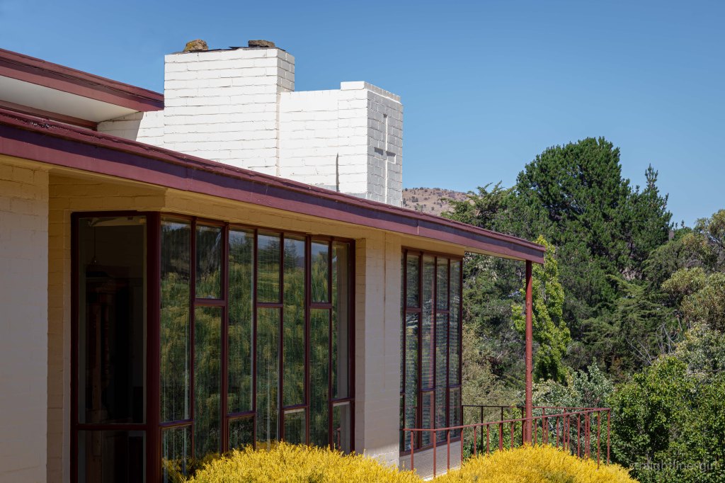
The Presbytery
The original church presbytery (date unknown) eventually become a convent and was subsequently replaced by in the 1930s by a new catholic school and convent. In 1929, the old school house was converted into a presbytery, presumably temporarily.
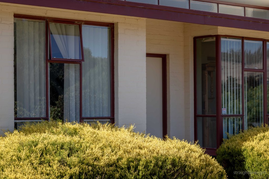
The current presbytery was designed by Paul Fox in 1957. The newly appointed parish priest, Rev Fr JB Reed had the design approved by the Archbishop Most Rev G Young DD, and it was completed in 1959 by the builder Mr E H Hewitt of Lindisfarne.
Presbytery front door
It’s a two-bedroom house with, we were told, an ensuite bathroom, which was apparently very uncommon in the 1950s.
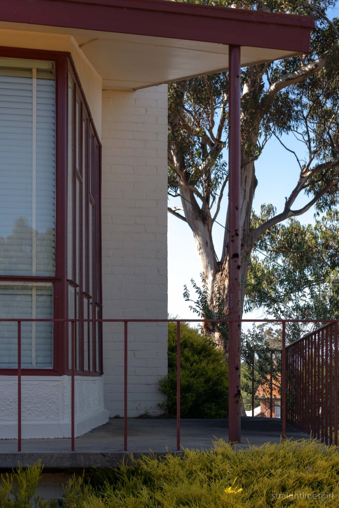
Presbytery seen from the old school house
At the building’s blessing and opening on 15 March 1959, The Mercury observed that, ‘although modern in design, the presbytery has been built so that it in no way interferes with the antiquity of the church’.
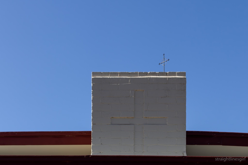
A pair of crossesWindowsThe endDetailLinesStrong verticalsMore strong verticals
I had a lovely morning exploring what I could of this wonderful building and meeting and greeting visitors to the school house. It was interesting to hear some of the stories people shared.
I think part of the fun of Open House is to meet people with common interests (or even uncommon interests!) and to learn interesting things about our built heritage.
And the day wouldn’t be complete without . . .
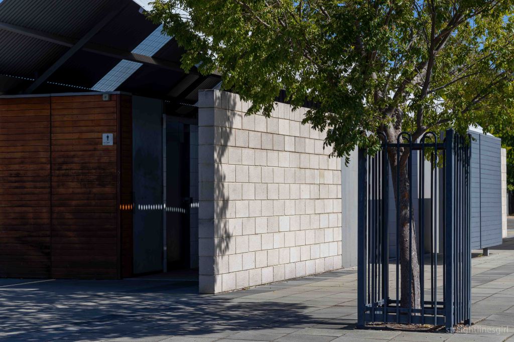
The Richmond Tourist Amenities
This was presented as an example of ‘contemporary architecture within a historic setting’.
The complex was commended in the 2004 and 2005 Tasmanian architecture awards:
“This building deserves recognition because it seeks to contextualise, within an historic setting. Through means other than imitation of historic forms. It is a well-considered approach, which reworks components of the familiar without pastiche. It also provides an innovative plan for an often maligned building type.”
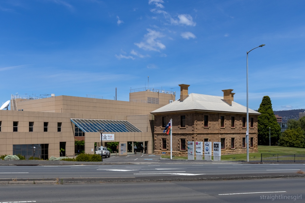
It was a short stroll from the Railway Roundabout Fountain to the site of the former railway station that gave the fountain its name.
The site, originally built in the 1870s for the Tasmanian Main Line Railway Company, is now home to the ABC HQ, and was open for tours during Open House.
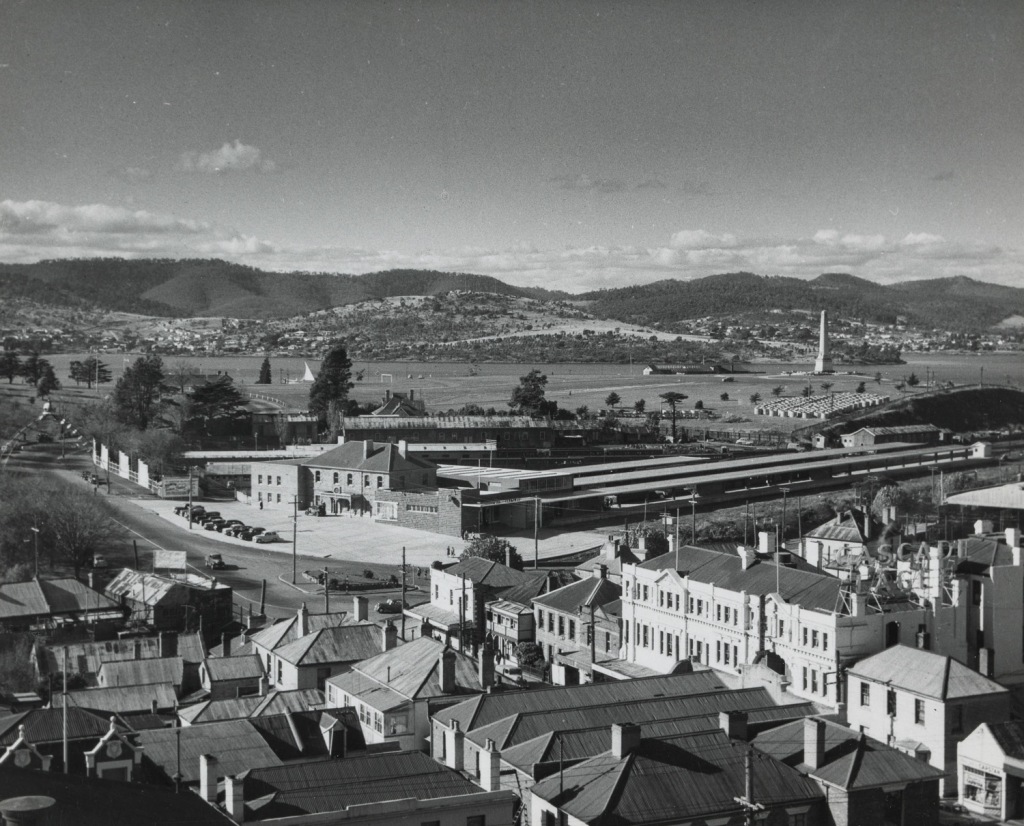
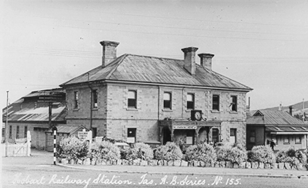
Here’s what the site looked like before the roundabout was built. What is now the ABC Building is in the centre of the photo, with the car park out the front.
Hobart Railway Station before 1961 (Source Tasmanian Archives & Heritage Office AA375-1-216)
If you look very closely at the far left of the photo, you can see the street arch with the crown on top that was made for the 1954 Royal visit and is now at theRiverfront Motel at Berriedale.
This was a self-guided tour of the studio so there was a lot of people lining up to get in, and the focus was on the ABC’s activities rather than on the architecture so I can’t tell you much about that.
The older building at the front of the site is the original railway station building from the 1870s. According to Col Dennison, the line opened in 1875 and the station closed in 1974.
The ABC site as it is today
A picture from Col’s book Yesterday’s Hobart Today shows a signal clock above a wrought iron porch at the front of the building.
Hobart Railway Station c 1940 (Source Tasmanian Archives & Heritage Office PH30-1-517)
I’ve seen some more recent photos of the site and it looks to have been a Datsun car parts office at one point.
If the ABC purchased the site in 1985, we can assume the large building dates back to around that time. It brings to my mind the CSIRO building on the waterfront, which was opened in 1982, so that sounds about right.
The ABC sign and some witches hats
The tour led us through the radio and TV studios, as well as a glimpse into the tech world.
Outside the ABC
A tiny studio, called the Tardis, captured my attention and as I was looking through the window, one the producers, Jo Spargo, told me this was where they do off-air interviews. She asked if I’d like to come in and talk about my story and my memories of the ABC.
She asked what my memories of the ABC were, and I said when I was a kid, ABC was the only channel we watched. We’d watch Doctor Who and The Goodies, my Dad would watch the 7.00 News and then the TV would go off. That changed a bit when we got older but that was my childhood.
My Doctor Who memories don’t go back quite as far as 1972
Jo said that was a lot of people’s childhoods!
Presenter Sabra Lane talked us through her day on the radio and explained how she works in the studio.
We saw the TV news and weather sets, where people were able to have a go presenting and reading from the teleprompter.
I’m not planning on changing careers any time soon (photo: Lil Sis)
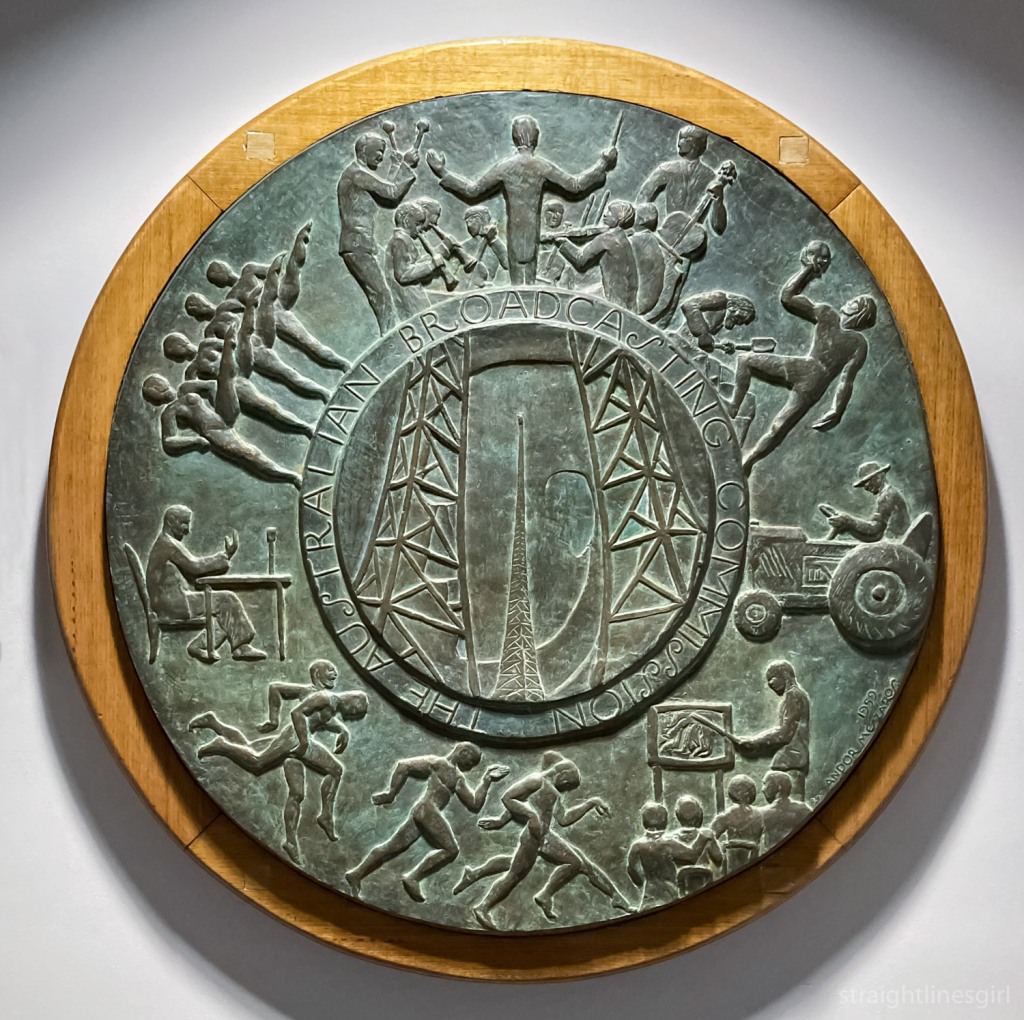
We saw a lot of historical relics from the ABC, including the gong used to announced the beginning and end of radio programs, and the ABC plaque.
The ABC plaque
According to the blurb next to the display, the ABC commissioned a plaque to put into its buildings after television was introduced into Australia. This was designed by Melbourne sculptor Andor Meszaros, who had designed the commemoration medallion for the Melbourne Olympics in 1956.
The description of the plaque says it shows surround figures depicting seven program departments, with the centre motif revealing a man’s head superimposed on a transmitter tower. This symbolises the mind at work and thoughts being transmitted.
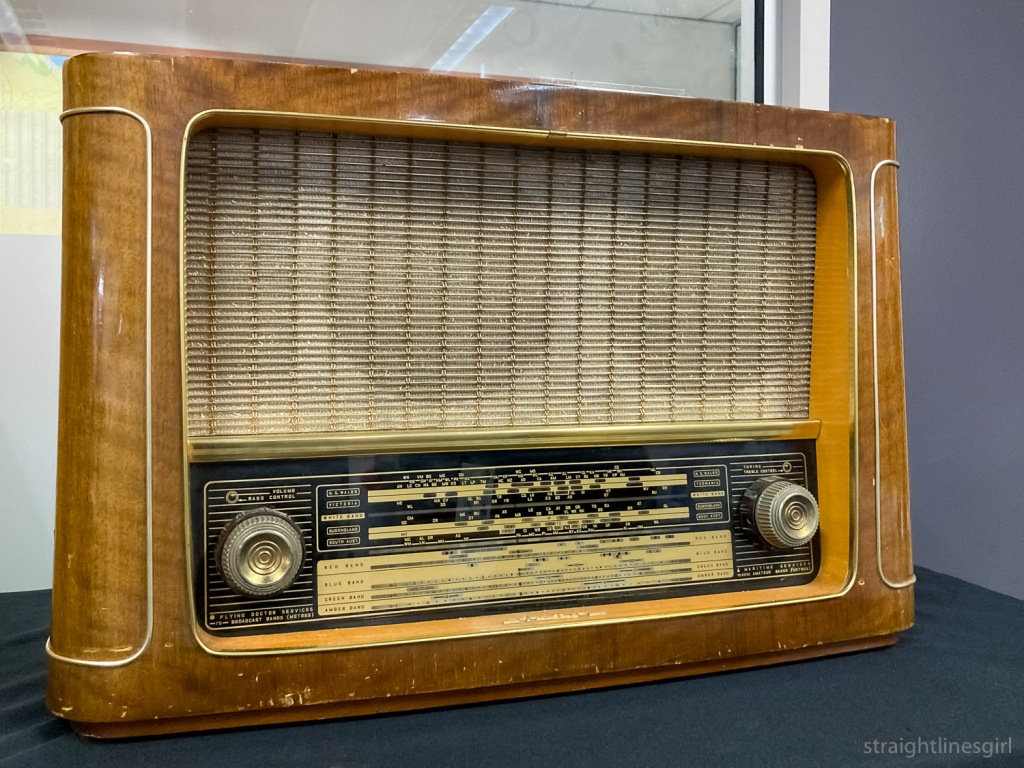
A very old radio
Speaking of childhood memories, we were also encouraged to take photos of ourselves with Big Ted and Jemima.
Childhood memories
Even though we didn’t learn much about the buildings, it was an interesting morning. I’d had no idea what it was like inside so appreciated the chance to walk through and find out.
Taking a close look at the outside
Thanks to the ABC and Open House for putting the day together.
The old railway office, now part of the ABC complex
This year, Lil Sis and I had a whole weekend of events planned. And to kick things off, on Friday I went to the architectural drawing class, which I wrote about on my other blog.
Open House is go!
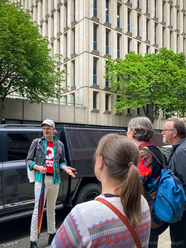
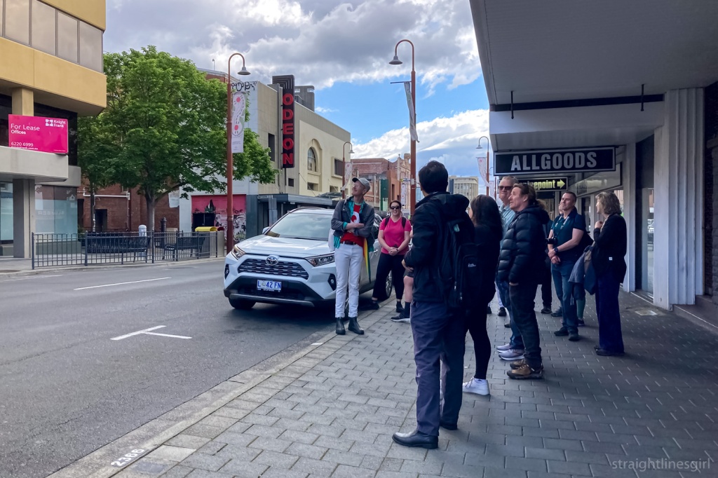
Our first tour was the Signs of Hobart tour, hosted by Brady Michaels. Brady has undertaken a massive trip around Australia to document signs, both well-known and obscure, before they disappear.
The tour promised to “reveal the hidden and not-so-hidden secrets of Hobart’s built environment, viewed through the lens of vintage signage, advertising and design”.
Start of the Signs of Hobart walking tour
It was a one-hour (and a bit because these tours always run over time) walk around Hobart looking at some of the well known and lesser-known signs that adorn our streets, starting with the Gibson Flour Mill in Morrison Street.
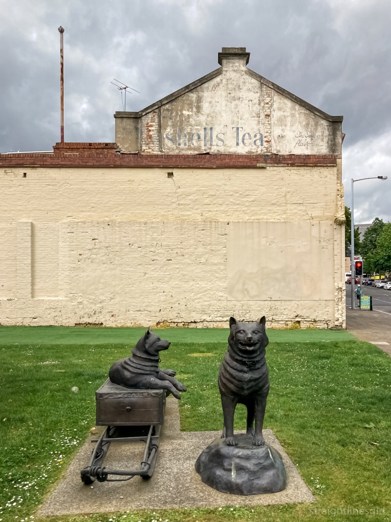
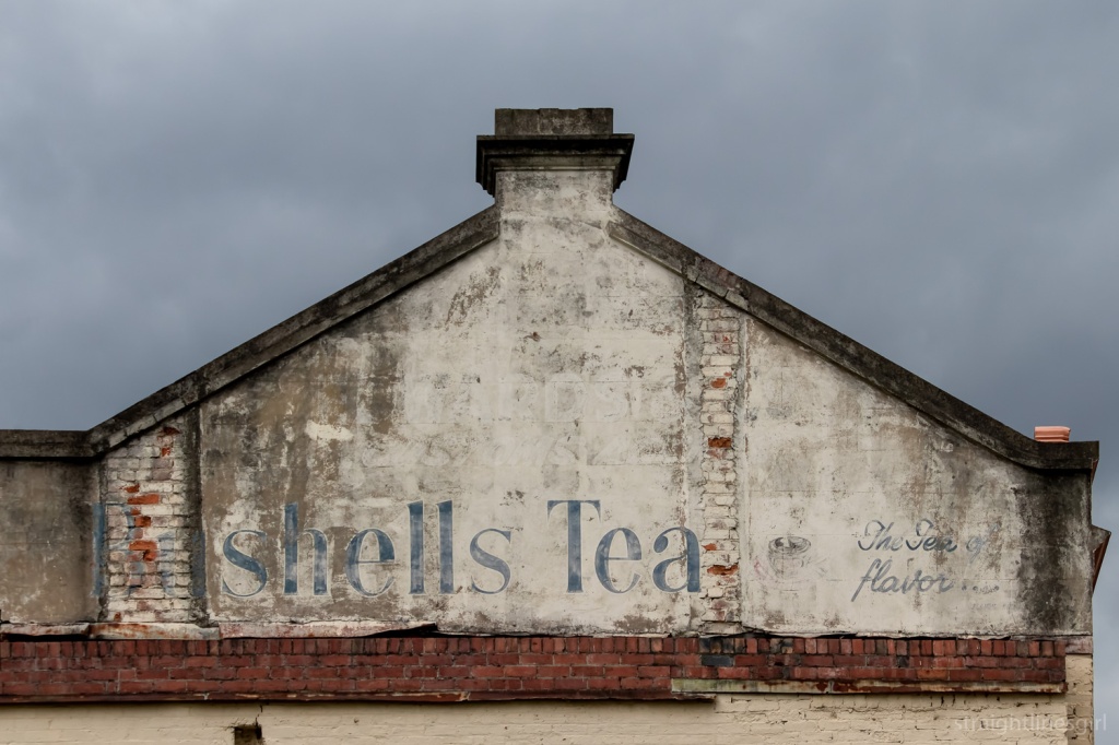
Bushells Tea, Argyle Street
Continuing around to Argyle Street, we stopped to look at the Bushells Tea ghost sign, near the replica Mawson Huts. I think this is a fairly well-known ghost sign in Hobart but I didn’t know that these signs dated back to the 1950s, when tea’s mantle as the most popular drink in Australia was being challenged by coffee. Brady said where you find a Bushells sign like this, you are (or would have been) quite likely to find a Robur sign nearby, as it was the other popular brand of tea at the time.
Bushells Tea sign
If you look very closely at this sign, there’s another sign underneath the white background, which looks like it might say something like “Wards Customs Ale” but it’s very hard to make out.
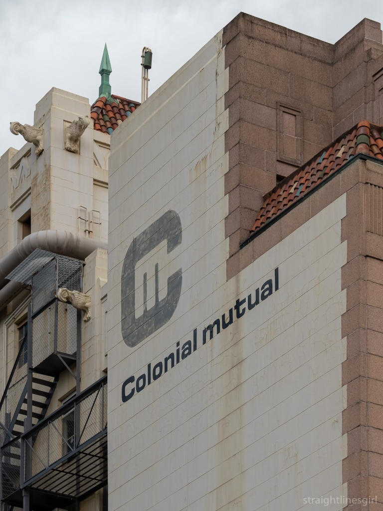
It was a treat to learn that one of our fellow walkers was the son of the sign writer who had made the Bushells sign! So we got an extra tour guide who had personal connections to many of the signs we stopped to look at, including the Colonial Mutual sign in Macquarie Street, which he had done himself.
Colonial Mutual, Macquarie Street
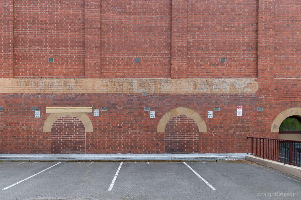
One of the cool signs we stopped by was a ghost sign I discovered a couple of years ago that marks the site of Hobart’s first public library in the Carnegie Building on the corner of Argyle and Davey Street. (This links nicely to one of Sunday’s tours.)
Hobart Public Library
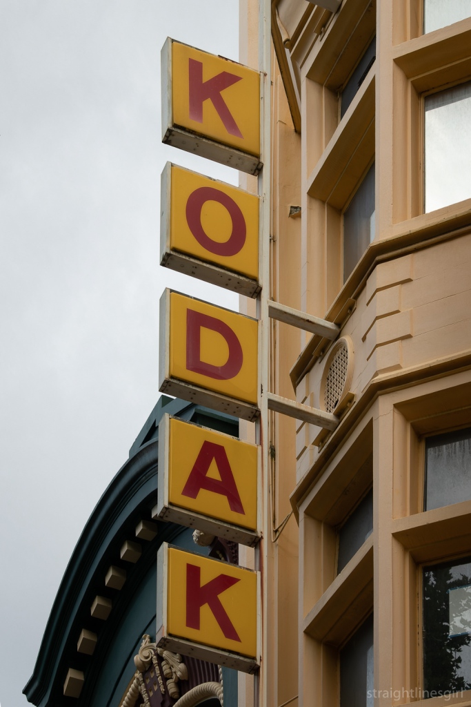
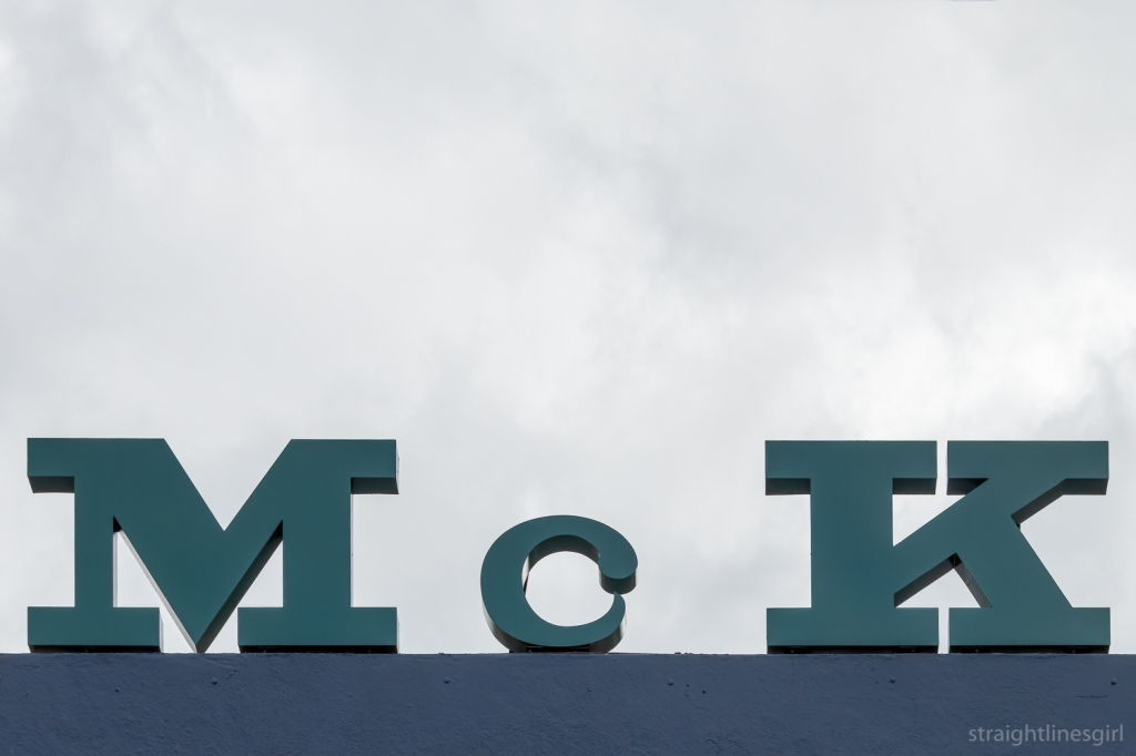
We made our way through the Elizabeth Street Mall stopping to look at some more signs along the way.
One of Hobart’s most-loved old signs, Kodak in the Elizabeth Street MallPart of the McKeans sign in the Elizabeth Street Mall
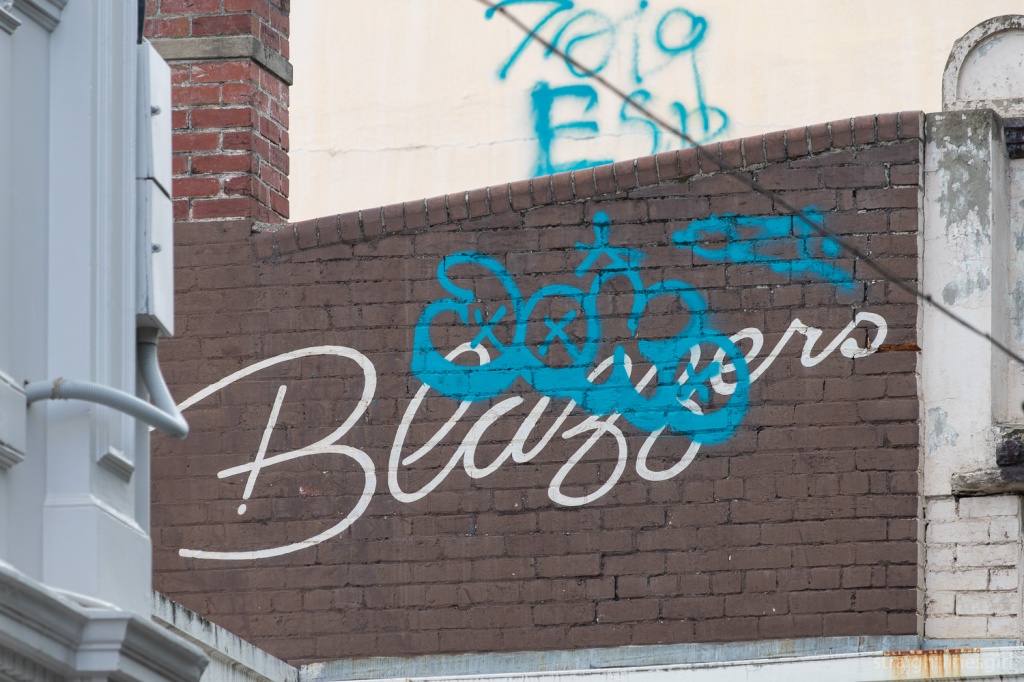
The beauty of tours like this is gaining a new appreciation of signs I already knew about, as well as seeing ones I must have passed by hundreds of times and never noticed, like this “Blazzers” sign. Brady thinks it was a coffee shop but no one remembers it.
Anyone remember Blazzers?
Brady noted that a some of the signs have been tagged, which is unfortunate. He said in other places, graffiti artists will leave old signs alone, but that doesn’t seem to be the case in Hobart.
I guess it adds another layer of history to them.
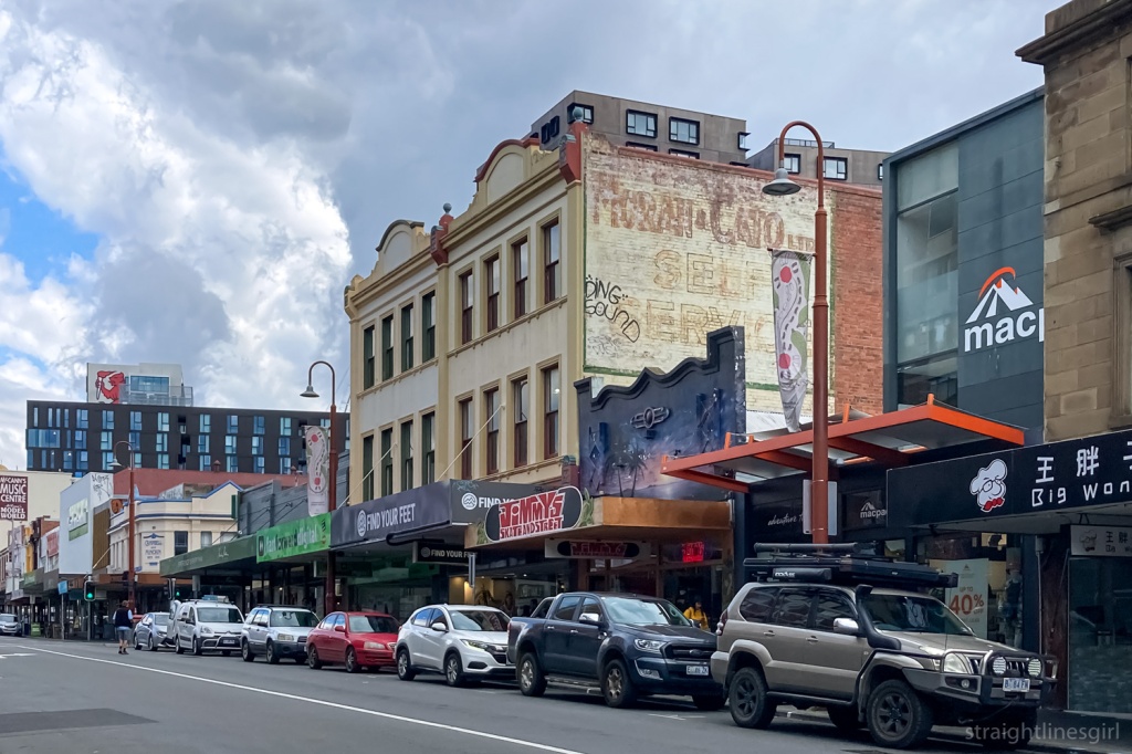
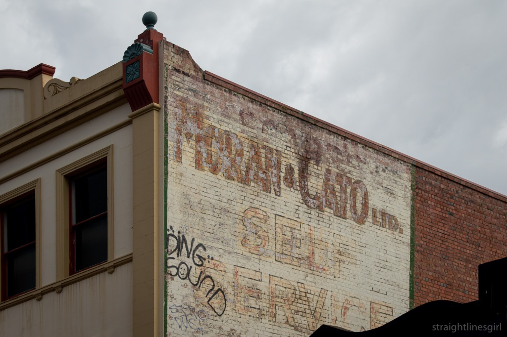
Looking up Elizabeth Street to Bathurst Street, past the Moran & Cato ghost sign
I’d always wondered about “Moran & Cato” from this sign further up Elizabeth Street
It turns out Moran and Cato was a chain of grocery stores established in the late 19th century, with stores across Tasmania in the 20th century competing with Colesworths. It converted most of its stores to self-service in the late 1950s and early 1960s, which gives a clue to the vintage of this sign.
Moran & Cato Self Service
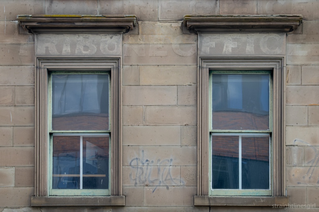
Just down the street from this building is this older ghost sign most likely from the Tasmanian Tribune, which appears to have been the local newspaper from 1872 to 1879.
Tribune Office
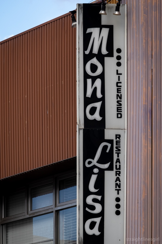
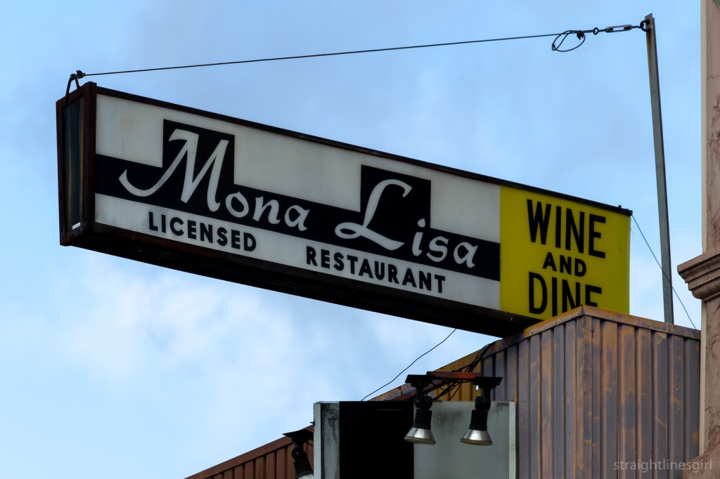
There’s some very cool signs along Liverpool Street, including the old Mona Lisa restaurant, which I’ve heard a lot of people in history groups reminisce about.
Mona Lisa, Liverpool StreetMona Lisa, Liverpool Street
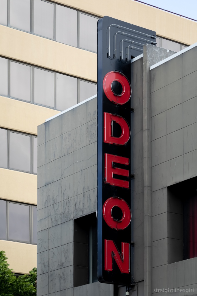
Liverpool Street is also home to the Odeon Theatre, formerly the Strand Picture Theatre, built in 1916.
Odeon Theatre, Liverpol Street
There are some other interesting signs on Liverpool Street and we stopped here to talk about some of them.
Checking out the signs on Liverpool Street
Our signwriter companion knew about this one, which I think he said was for a restaurant.
Yin Yang, Liverpool Street
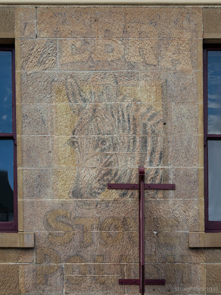
In the next block is the Zebra Stove Polish sign on sandstone, which isn’t a common surface for painted signs like this one. Brady said it was one of his early discoveries. He said he’d been having a meal in the Shamrock Hotel over the road, looked out the window and there it was.
Apparently, it looks better when it’s raining as the water brings more contrast out.
Zebra Stove Polish
Zebra Stove Polish is, as you might imagine, polish for cast iron stoves
We need to start a campaign to get rid of the metal sign the current business has stuck right in the middle of it!
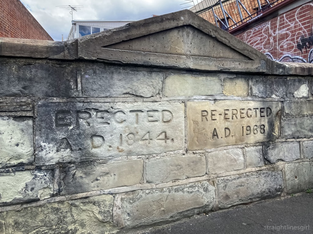
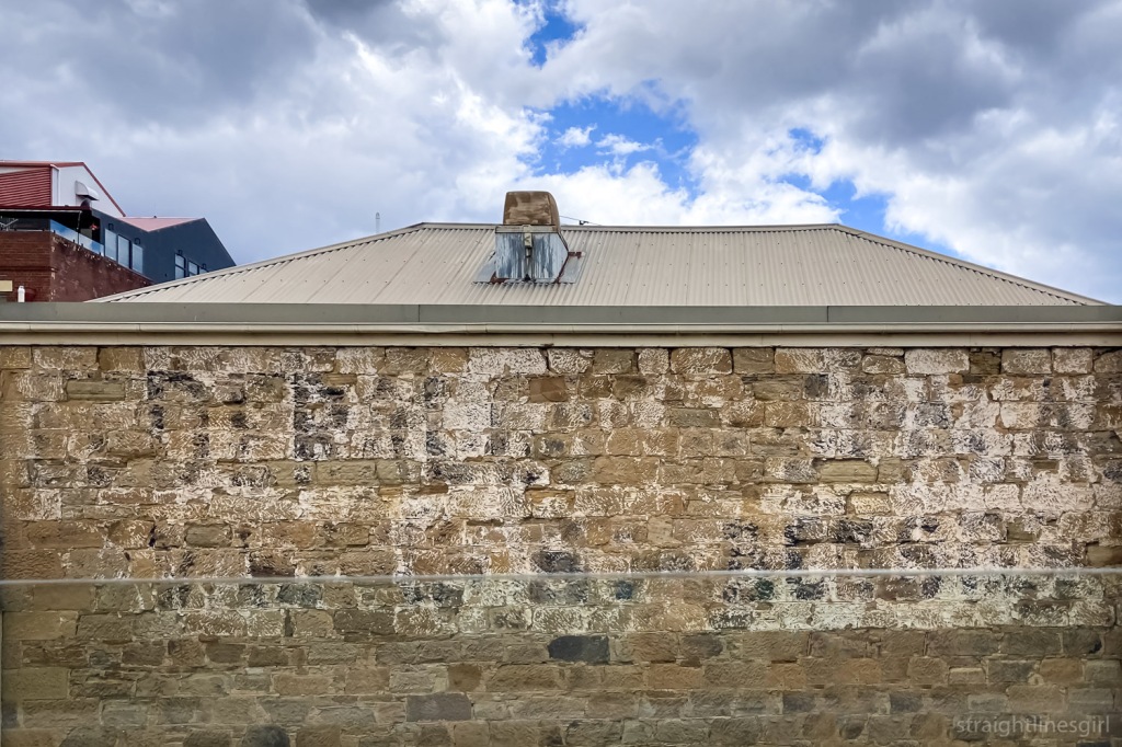
Our final stop was back on Macquarie Street, walking past the former public toilet block near the former Redline Coaches depot in Harrington Street, which someone accurately described as having been “a dump”.
The ghost wall that was erected and re-erected and used to front a rather unpleasant toilet block
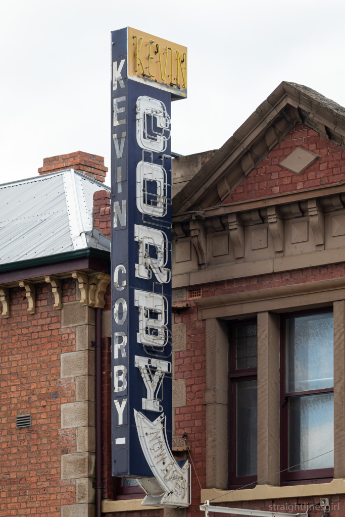
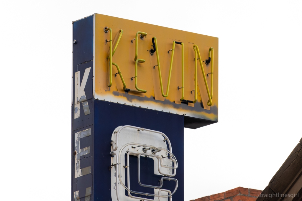
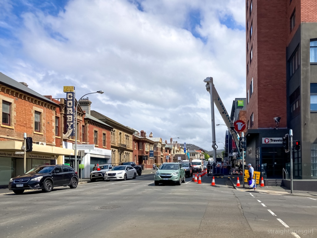
In this area of Macquarie Street, just up from Harrington Street, we had a minor medical precinct. Near the intersection is the Kevin Corby Pharmacy and its fancy neon light, and further up the street is another former pharmacy that used to (from memory) have a huge green and red neon sign that alternated NOW OPEN/24 HOUR or some such. It’s now the Australian Nursing and Midwifery Foundation office.
This one alternated between ‘Corby’ and ‘Chemist’.
Former Kevin Corby Chemist, Macquarie Street
Brady recalled that the Kevin Corby sign was the first neon sign he’d ever seen, coming in to Hobart on evening from the Huon Valley as a kid.
Kevin
I can remember staying in the Travelodge across the road on a school trip once, so it’s most likely I saw this sign as a young person too, but I don’t have any memories of it from that far back!.
Macquarie Street with Kevin Corby and the Travelodge in the foreground. The ANMF building in the far background was also once a pharmacy
This was the end of the tour but we didn’t quite end there because some of us had to go back with Brady to OHH Central, to pick up our copies of the book.
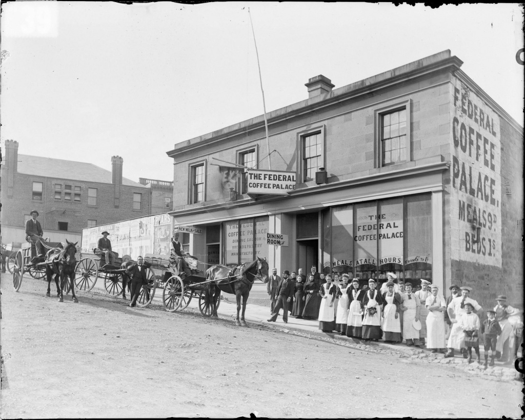
So we had a chance to take in a couple more signs on the way, including more sandstone on the side of the Royal Tennis Courts, and the former Federal Coffee Palace in Murray Street, which is now Daci and Daci.
Former Federal Coffee Palace, Murray Street (now Daci & Daci)
It was fitting to end the tour here, since we’d started the morning talking about the competition between tea and coffee in the 1950s.
Federal Coffee Palace, Murray Street (photo from Tasmanian Archives and Heritage Office NS1013-1-365)
Coffee palaces were introduced by the Temperance movement, as a no-alcohol alternative to pubs, in the late 19th century. But from what I can tell, in Australia, no one drank coffee at that time; they all drank tea, so these establishments actually served tea. It doesn’t sound like they were wildly popular venues, so they didn’t last long and some of them actually ended up becoming hotels.
It was an interesting tour. I hadn’t really thought about it before, but these signs really do tell stories of our past. As the Signs of Australia website says, “They tell us who we are and how we got here, and they preserve a history of commercial sign writing and typography too.”
Thank you, Brady, for sharing your passion for this fascinating part of our history.
Our final tour of the Open House Hobart 2021 weekend was the Anglesea Barracks tour that we didn’t get to do last year because it rained. Last year we spent the entire tour in the military museum, which included a tour of the site via a model that had been constructed in the 1940s.
By the time we arrived, it was starting to look like this might happen again, with a light rainfall, but thankfully our guides decided to press on, with one group starting in the museum and the other walking round the barracks. We were in the second group so we got to walk around.
The site was chosen by Governor Lachlan Macquarie in 1811, with the first buildings on the site dating back to 1814.
Fraternisation between soldiers and convicts was understandable as many shared a common class background and also fought together in military campaigns throughout the Empire. With the establishment of the barracks, contact with the convict population was restricted and the feared threat of moral contamination and behaviour was minimised.
The site on top of Barrack Hill, the name Macquarie gave the site, gave clear and strategic views of the river, the settlement and the new Signal Station at Mount Nelson. Its influence over the town was more than military. The barracks became the social hub of the settlement and it was commonly said that ‘the best view in town could be had from the Officers Mess’ (now the Sergeants’ Mess).
The first building we looked at was the Guard House (1840), which is on your right as you enter the barracks. Merv, our guide pointed out the Spanish influence in the arches of this building.
Guard House. Designed by Roger Kelsall (Commander Royal Engineers). Built on the site of prior Guard-houses. It had 4 cells for soldiers that had committed misdemeanors or broken curfew.
The Soldiers Barracks (1847-48)
Designed by James Conway Victor (royal engineer). The third major barracks on the site the building was originally named “Anglesey Barracks” after the Earl of Anglesey. Later the name with its current spelling came into common usage for the whole precinct. In 1901 this building was extended to complete its original design necessitating the demolition of the first barracks building, the “Old Soldiers’ Barracks”. The original Soldiers Barracks, built in 1814, is thought to have been designed by Elizabeth Macquarie.
The Soldiers Barracks (1847-48)
The Field Officers’ Quarters 1814 (now used as the Navy HQ).
Designed by Lt John Watts, aid to Governor Macquarie, or possibly Mrs Elizabeth Macquarie. This is the oldest remaining building at Anglesea Barracks. It provided separate apartments for a field officer and four captains , with their wives, families and servants. It included private kitchens, toilets, kitchen gardens and harness rooms at the rear (now demolished.
Navy HQ
We also saw the parade ground, and the area set aside for memorials and tributes to people who died while on military service. Further round, opposite the Navy HQ is a row of buildings from 1827-1842.
The Subalterns/Officers Quarters (1827 – 1842)
Terrace
The Northern terrace was designed by David Lambe. The Southern and infill terraces were designed by John Lee Archer. This building was constructed in three stages over fifteen years and completed the enclosure of the Parade Ground. The first stage, the lowest of the three terraces, provided a Captain’s quarters and the Officers’ Mess – the social centre of Hobart Town. The later two stages provided accommodation for junior officers. Behind the terrace were kitchens servants’ quarters and a privy. These were demolished many years ago.
A side alleyMore side alley
After exploring this part of the barracks, we met up with the group from the museum and they started splitting us up into three groups for the second part of the tour. Lil Sis and I were exhausted by this point, and having gone through the museum in fine detail last year, decided to skip this part of the tour, so we thanked Merv and departed.
It was another fabulous weekend, and we thank everyone from Open House Hobart for organising this event and the volunteers who ran things so smoothly at all of the venues. We especially thank the home and building owners who allowed us in to see these places, take photos and ask questions. We’re looking forward to seeing more in 2022.
Our first stop was the Wrest Point Casino, which is a site than contains far more than the 74-metre (or 73 metres or 75 metres?) tower building that is, I believe, still Hobart’s tallest building.
Our tour guide was Graeme Tonks, who has written a book on the history of Wrest Point, which I’ve referred to to make sure I’ve got my facts correct in this post. He said that the tour was going to focus only on the architecture of the site, not any of the social and ethical issues that might come up around the casino, which I think was good to set out up front. The time for that discussion was not now.
Prior to the British arrival, the point was a camping ground for the muwinina people, who lived in the area we now call Hobart, but who did not survive British colonisation.
We started the tour near the front gates on Sandy Bay Road, where Graeme gave us a brief history of the site. In 1808 the site was granted to former Norfolk Island convict Thomas Chaffey, as part of a 62-acre parcel of land that extended up to the Mt Nelson track. He built a house on the promontory, which he named Chaffey’s Point.
Graeme mentioned that Chaffey’s Point became the place where people who had been executed were strung up. In part, this acted as a warning for people on any approaching boats of what would happen to them if they broke the law. The hanging place was moved from Hunter Island in Sullivans Cove because the locals found the smell and sight of decaying bodies around the wharf area offensive. I can’t imagine Mr Chaffey and his family would have particularly enjoyed the sight and smell from their home either. At around the same time, the authorities established a whaling station next to the point, so it must have been a barrel of olfactory unpleasantness for the people who lived there.
Thomas’ son, William Chaffey, built the Travellers Rest Inn on Sandy Bay Road in 1836. It’s still there but no longer used as a hotel. It houses the computers that run the gaming facilities in the casino. After his father’s death, William Chaffey sold part of the site, including the promontory, to David Dunkley, who built his own home, St Helena, there. Graeme said that Dunkley was also responsible for the Duke of Wellington Hotel on Macquarie Street, which explains the name “Dunkley” appearing on the side of the building. I’ve often wondered about that.
George Robertson acquired the property in 1898 and rebuilt St Helena. In 1928, Mrs Ina Lucas, who was originally from NSW and had lived in Cressy, deciding to move to Hobart with her alcoholic husband to try and keep him away from the booze (not entirely sure that was ever going to be successful), bought the property and built a new home called Wrest Point. This home was designed by the architect Lauriston Crisp, whose own home ‘Iluka’ (1926) is not very far away on Sandy Bay Road.
The gateposts were from Mrs Lucas’ time, and they are original, with the northern one having been moved further north later on to accommodate a larger gate.
After some digging around, Graeme discovered that the sandstone for these posts had come from Cressy. The clue to this, apart from it being where Mrs Lucas had lived, was that the sandstone hasn’t deteriorated in the way that much of the sandstone sourced from the south of Tasmania has done. Apparently northern sandstone can withstand the salt air better.
Mr Lucas died in 1929, and Mrs Lucas moved to England with their two sons in 1934. She sold the property to Arthur Drysdale in 1936. Drysdale was one of Tasmania’s most successful businessmen, who after running a string of farms, meatworks and butcher shops, would go on to run the Tasmanian lotteries.
Moving into hospitality, Drysdale had the Wrest Point Riviera Hotel built on the site in 1939. It was designed by the team of David Hartley Wilson and Colin Philp, who are responsible for several rather lovely art deco/moderne streamline buildings around Hobart. (Including, I was surprised to learn, the Shamrock Hotel on the corner of Liverpool and Harrington Streets.)
The entry of the former Wrest Point Riviera Hotel (April 2020)
What’s most interesting about this is that, rather than demolish the Lucas house, because it was only new, they built the hotel around the house, so there are elements of Mrs Lucas’s Wrest Point residence within the hotel itself. This includes some external windows (on the right of the above photo), the ladies’ powder room and rest room, and the study, which is untouched (and currently used for storage).
This has to be the best thing I heard all weekend!
Graeme showed us a plan of the house overlaid with the hotel so we could see how it had been done, as well as an early photo of the hotel. From the river, it would have looked absolutely stunning.
He also said there were seahorses on the entrance, which have long since disappeared. I wasn’t sure if these are original from 1939, but I found this photo on the Tasmanian Archives website and I thought they looked a bit too kitschy for 1939. According to Graeme’s book, however, they were part of the original design, in keeping with Drysdale’s P&O design for the hotel, which was intended to capture “the feel of an imposing luxury liner berthed off the sparkling waters of the Derwent River”. A grand building, lavishly fitted out, it provided a standard of hospitality and entertainment previously unknown in Tasmania.
Entry of the Wrest Point Riviera Hotel in the 1940s (Photo from Libraries Tasmania online collection PH30/1/5524)
Graeme took us through the old hotel and pointed out where modifications had been made over the years. For instance, the reception area, which had been in the main entry hall, is now within the ground floor of the tower building, and some of the older accommodation is now used as offices. A lot of the older rooms had shared bathrooms so couldn’t be used for accommodation any more.
The beautiful staircase leading from the ground floor of the former Wrest Point Riviera to what is now executive offices
There’s also a couple of public phone booths built into one of the walls, where guests could take calls.
Wall detail in the former Wrest Point Riviera
We went into the Derwent Room, which used to have space where a full band would play, and a dance floor. This made the hotel a massively popular entertainment venue for the Hobart community and was the place to go for American servicemen posted here during World War Two.
Light from the Derwent Room
As we walked into the tower building from the Riviera, Graeme showed us a photo of the architect’s model, which, sadly, no longer exists.
Crossing from the hotel to the tower via what used to be a balcony
The tower was designed by Sir Roy Grounds and completed in 1973, but not without its share of controversy. The issue of a gambling licence to the Federal Group, which bought the hotel in the 1950s, was the subject of much community concern and it ended up going to a state referendum. From what I can find out, Federal Group proposed that a casino would be a great way to attract more tourists to Tasmania, as there were no legal casinos anywhere else in the country. The “yes” vote narrowly won and the casino became a reality in 1973.
Wrest Point with the Casino Tower (1973), and the old art deco Wrest Point Riviera (1939) obscured by a more recent addition
Graeme pointed out the lift from the ground floor to the first level, which was installed so the Queen didn’t have to walk up the stairs. It’s exquisitely fitted out in blackwood, and is the slowest lift in the history of the world. (So I’m told. I was too impatient to wait for it and find this out.)
Our last stop was the Birdcage Bar, a cocktail bar that was installed a couple of years after the building had been completed. It’s best known for its frescos, painted by the surrealist artist Charles Billich. Most of the women are real people and many of them were dancers from the cabaret show. One of the women had a zebra stripe cape, and Graeme said that this, along with several other boxes of show paraphernalia was discovered in the attic of a Sandy Bay house by new owners, after several previous owners hadn’t even noticed them. This stuff is all now back with Wrest Point.
Billich frescos in the Birdcage Bar
Graeme told the story of one of the women, Honey Hogan, who later married former Premier Jim Bacon. Honey had been one of the original croupiers at the casino. Graeme said that because the casino was so new, they couldn’t use “experience” as a criterion for hiring croupiers because there was no one in Tasmania or even Australia who would have qualified, so other factors came into play, none of which, I imagine, would get through anti-discrimination legislation now!
One of the other painted women isn’t real, and her backside lines up with the head of the person who might happen to be playing the piano. Graeme explained that this was because of a disagreement between Billich and one of the pianists, and this picture was his response.
Over time, these images were deemed to be dated, and there were plans to paint over them, but what ended up happening was false walls were built over them and they were forgotten. It was only much later that someone remembered they were still there, and they were able to remove the flat walls and invite Billich back to restore his work.
The tour was fascinating and went for much longer than the allocated 50 minutes. Graeme said he was planning a return tour early in 2022 for anyone who was interested (me me me!) that would be longer and would cover a lot of the spaces we didn’t get to see today, like the spiral staircase leading to the high rollers’ room, and its amazing mural.
The casino is currently being redeveloped for its 50th anniversary, and this includes moving the original casino room to a space with windows. This is apparently unheard of for casinos: gaming rooms traditionally don’t have windows. Or clocks.
At the date of posting this, I’d just been on the longer tour with Graeme, so stay tuned for a follow up post of some of the other features (and lots of photos) of this property , which, love it or hate it, has played a massive part in Tasmania’s social and economic history. Thanks to Open House for organising the tour, to Wrest Point for making it possible, and to Graeme for taking the time to share his knowledge and insights of this Tasmanian icon.
Additional information and clarification of dates came from Our Tasmania: Sandy Bay, from Graeme Tonks & Mark Dibben’s book Wrest Point: The Life, The Times and the People of Tasmania’s Hotel, and from the follow-up tour of Wrest Point with Graeme in February 2022.
Concluding Saturday’s Open House Hobart journey, Lil Sis and I visited the Princes Park Magazine, underground from my favourite public toilets in Hobart.
One I prepared earlier: Princes Park toilet block and Empress Towers in the background
We met Sarah, the Senior Cultural Heritage Officer from the Hobart Council, who told us some of the history of the site, which was built to house gunpowder for the guns of the battery that was built above it. There were a number of batteries built around the River Derwent from 1804 to protect the port from potential invaders over the years, including French, Russian (in the mid to late 19th Century) and German (around the time of World War II) fleets. These include the Alexandra Battery in Sandy Bay, The Queens Domain Battery and the Kangaroo Bluff Battery on the Eastern Shore, which we visited a couple of years ago through Open House.
Underneath the popular Princes Park in Battery Point, a disused, fully intact subterranean magazine can be found. Built in 1840 to carry 144 barrels of powder, or 200 rounds, the Prince of Wales Battery became a public recreation ground in the 1880s. Explore the subterranean space, designed as a ‘room within a room’ to absorb the shock of accidental blast.
Open House Hobart
Thick walls!
In what sounds like a series of blunders of judgment by people who were a bit too worried about being invaded, there were three batteries built in this area. The first, the Mulgrave Battery (1818), was near the current CSIRO site and too close to sea level for anyone to be able to see any potential threats sailing up the river. The batteries on the southern tip of Sullivan’s Cove led to the promontory being called “the battery point”, which eventually became the name of the entire suburb.
According to the ABC, it’s been described as a “poor pitiful mud fort” that was likely to shatter if fired upon, and as noted, by the time anyone saw any threatening boats from there, it would already be too late.
The Prince of Wales Battery, further up the hill, replaced the Mulgrave Battery in 1840. It, along with the original Prince of Wales Hotel nearby, was named after Queen Victoria’s son Albert Edward, the Prince of Wales. The magazine we visited was built underneath this battery to store the gunpowder. Sarah noted that it was rather small, able to hold 144 barrels, which was much less than the Queen Victoria magazine on the Domain (which we saw a couple of years ago) could hold. The Albert Battery was subsequently built even further up the hill during the Crimean War in the 1850s.
The Royal Engineers designed the powder magazine, and Sarah explained how it was built on a “room within a room” principle. It actually looked like a little one-room house with a gabled roof and four-feet thick walls that would absorb the impact of any accidental blast. Neat hey. There were steps outside the room leading up to the battery.
The steps that used to lead to the battery above
It was all covered over in the 1860s and the batteries were decommissioned in 1882, when the land was handed over to the Hobart Council. The council redeveloped it into a park in 1934, when the magazine was “rediscovered” and the new entrance and the iron gates were constructed, together with the plaque that has a fairly major mistake on it. Most of the time these are kept locked and Sarah said it’s great to be able to open it up for tours like this. It was an interesting tour and built on some of the history we already knew about the battery system dotted around the city.
Sarah also talked about how this all linked in with the semaphore signalling system used in the 19th century, and mentioned the nearby Signalman’s Cottage, which featured in an episode of Restoration Australia. It would appear I am the only person in Hobart who hasn’t seen this.
A wall of the “room with in a room” is on the left (I think!)
When I got the idea for the 50 in 50 project, I thought it would be interesting to challenge myself to take a photo every day with the same lens, and to restrict myself to using only that lens for a whole month to see what new perspectives I could get by limiting my choices. I had initially thought I’d use my 24mm prime lens because, well, because I love it and I could see myself using just that lens forever and never using anything else.
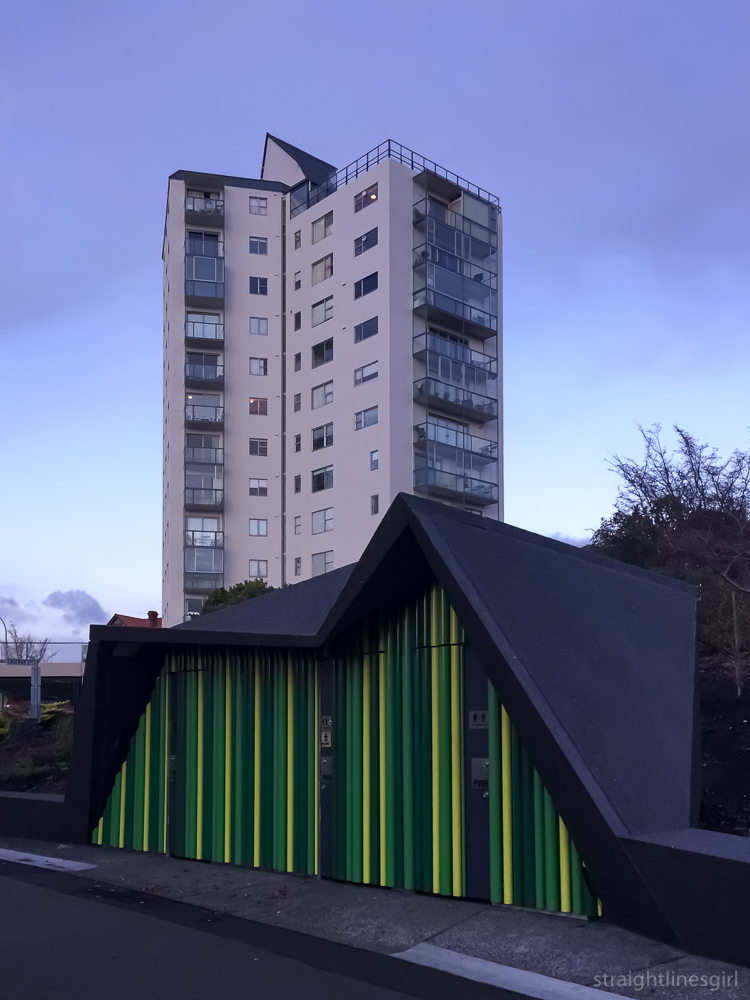
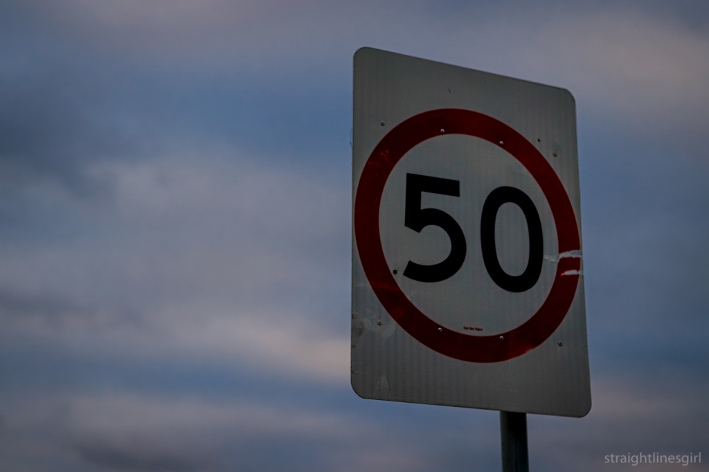
Day 50: 50
But loving that lens so much, I didn’t think that it would be a huge challenge to not use it. The 50mm, on the other hand, well, that was something different. I wasn’t exactly sure why I’d bought it and I’d rarely used it. I think I’d heard it was a good lens for portraits but, as portraits aren’t a genre I’m very interested in at all, I’m not sure what I thought getting a portrait lens would achieve.
Nonetheless, I had it and it was sitting there in my lens bag unused. Everytime I went to use it, everything would be SO CLOSE and I’d hastily swap it for my 10-22 where I was a lot more comfortable.
I’d set myself the goal of completing a 30-day project with one lens in 2020 as part of my 20 in 2020 list that I write about on my other blog. I realised at the end of October that time was running out if I wanted to get this done. I was on a short break in the middle of a very frantic time at work when I decided, in that way you make crazy decisions when you’re relaxed and on holidays, that I was going to start the project the very next day with the 50mm lens and it was going to be a 50-day project, not a 30-day one. Because 50/50/50 was just so much tidier than 30/50/30.
The challenge was set and the rules were made. I locked all my other lenses away in my camera bag and began. The main rule was that I needed to make at least one photo every day and post it. I didn’t actually have to edit or post it the day I took the photo, as long as I’d actually captured a photo every day. I was a little bit flexible with the challenge and I did allow myself to continue to use my phone for thing I’d normally have used my phone for anyway like casual daily photos and Hobart Street Corners.
So what did I learn?
Not allowing myself to crop the images, other than what was needed to straighten them, meant that I had to be a lot more careful in my framing in-camera. In some photos that were very tight, I found it difficult to make the adjustments I needed to compensate for the viewfinder showing me a slightly different view than what appeared in the image. More than once, an image that I thought I’d framed perfectly ended up with something I thought I had excluded sneaking in on the right hand side, or the image wasn’t framed exactly the way I had thought it was.
Day 2: It’s not centred!
It was also difficult to step back as far as I needed to get what I wanted into the frame, so in a lot of photos I ended up getting closer and including less in the image than I had intended. This is why there are a lot of photos from the challenge of the tops of buildings or details, because the 50mm perspective just didn’t allow everything to be included. There are limits to how far you can step back sometimes, because there are things like brick walls or roads with heavy traffic that stop you. Getting run over in the pursuit of my art is not really the way I want to end my life!
Day 5: Just one more step back would have helped this one
Doing this challenge forced me to look at things in a different way to how I would have if I was using the 10-22 lens and trying to get everything in. It helped me to isolate details that I found interesting and to really think about what was interesting about a scene. It often felt like it was a lot more of a personal way to make photos, to find the element that spoke to me within what was usually quite a cluttered space, and to focus on that and to show it from my perspective.
I’d go out with one idea in mind and then, after being in the space for a while and taking the photos I thought I’d wanted, I’d look around some more and see something completely different. I’d then go and explore the things that had caught my eye and end up with a totally different image to what I’d imagined. Light playing on a surface, a creeping shadow, a small feature that I’d never have noticed if I’d been looking at the big picture. Something on the ground. Something sitting on a fence. I’d capture these things as I saw them, and I’m glad I did because, more often than not, I’d come back the next day and they’d be gone.
Day 29: Specs in time. I came back the next day to rephotograph this scene because I wasn’t happy with any of the images, and the dandelion had gone.
Of course, not everything worked out as I’d wanted it to, and some days I ended up just taking a photo of something, anything, just to complete the challenge for that day. These were not some of my best moments.
Day 35: Hmmmmmmm……
I found I really enjoyed getting up close to a feature and making it the focal point of the image, with a very shallow depth of field to blur the background.
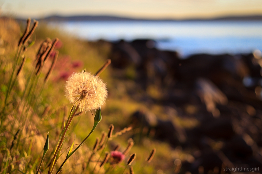
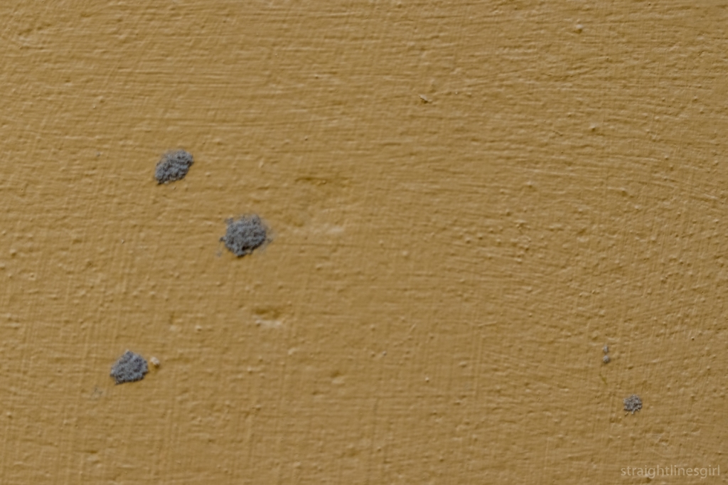
Day 31: Some sandstone at some old building
Some of these types of photos worked well; others not so much. I had a couple of days where I’d get a photo I really liked only to find I hadn’t quite nailed the focus, whereas similar shots with less pleasing composition were tack sharp. What to do there?! My choice was to go with composition over sharpness and to remind myself it’s okay to take more than one photo of exactly the same thing if I think it’s going to be a good one. Maybe one day I’ll remember this.
Day 42: Composition trumps focus
16 December was the last day of the challenge and I’d already picked out my subject a couple of days earlier on my morning walk, when there was great light. I’d taken a few test shots and thought I could make it work on the last day. All I needed was the same light and the same lack of traffic on the highway. Sadly, the light didn’t come and I woke up feeling very unwell. Not unwell enough to not go for a walk but not exactly raring to go either. So I didn’t get the photo I wanted to round the project off. I took a couple of photos while I was out but nothing really worked and all I wanted to do was go back to bed. Which I did.
It was a disappointing end to what had been a fantastic project that, for the most part, I enjoyed doing. Overall, I’m pleased with the photos I made for the project, and there are a couple that are up there with my favourite images of the year.
Day 10: A re-edit of one of my favourite photos from the whole of 2020
I’m not in any great rush to stop using the lens and, now I know some of its possibilities, I’m keen to use it more often.
Day 38: I love this one and several of the others I made at the same location
It’s been a great experience for me. I would say if you feel like your photography is getting stuck or same-y or you want to mix it up a bit, set yourself a challenge like this where you restrict yourself to one element. Go out for a couple of weeks, a month, however long feels right to you, and make photographs every day within that restriction. Maybe you could restrict the lens, or the aperture you use (or even both!). You could restrict yourself to making a photo at a particular time of day or within a particular location. One challenge I have always been interested in is the “one block” challenge, where you can only make photographs of things that are within one block of your town for whatever period you choose. Maybe a back and white challenge is more your thing (I did that for a year in 2018), or you photograph only yellow things every day for a month. Or birds. Or cups of coffee. Or sandstone (nah, just kidding, don’t do that). Anything where you limit your options, I think, will help you to focus on one thing and to get more creative as you can’t get distracted by the many other variables that could distract you.
Now I have to plan myself a new challenge for 2021.
Have you thought about undertaking a photo challenge like this? Or done one? Let me know in the comments.
These are the photos from the third week of my 50 in 50 challenge, where I use only my 50 mm lens for 50 days and post a photo a day. I’ve been a bit behind in posting because I had all the Open House Hobart photos to post as well, so there will be a couple of catch-up posts now.
Day 15: The GullDay 16: The Supreme CourtDay 17: Abstract sunriseDay 18: The Magistrates CourtDay 19: RustDay 20: RooftopsDay 21: Three